About Panama · About the country
Panama’s Roads
Highways that link oceans, cities and investment opportunities
Panama is often called a country of water: the canal joins two oceans, and thousands of ships pass through it every year. But there is another network that quietly shapes the country every day — its roads.
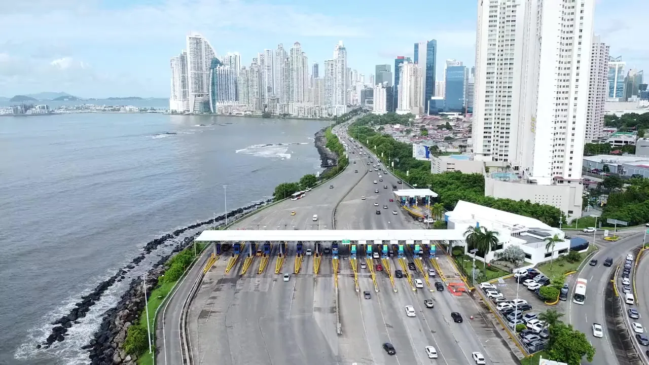
Modern highways, winding mountain roads, coastal routes and international highways link Panama’s cities, beaches, business districts, farms and ports. They carry people rather than ships — and for anyone thinking about living in Panama or buying property there, they matter as much as the canal itself. Roads determine how long the commute takes, influence home prices, shape tourism and open up new areas for investment. In many ways, Panama’s road network tells the story of how a small country became one of the most connected economies in Latin America.
A Country Along a Single Long Road
Panama has a remarkably simple geography. The country stretches more than 750 kilometers from west to east, yet it is surprisingly narrow: in many places you can drive from the Pacific to the Caribbean in under two hours.
Because of this shape, one road carries enormous weight — the Pan-American Highway, known locally as the Carretera Panamericana. It is the backbone of the country’s transportation system. It begins at the border with Costa Rica in the west, crosses almost the entire country and runs on into eastern Panama.
Along the way, the highway links the main cities and provinces — David, Santiago, Penonomé and Panama City. For millions of Panamanians this road is part of everyday life, and for investors it is one of the most valuable pieces of the country’s infrastructure.
Roads determine travel times, influence home prices, shape tourism and open up new areas for investment.
The Pan-American Highway: One Road, Two Continents
The Pan-American Highway is one of the longest road systems ever built. In theory it runs from Alaska to the south of Argentina and passes through almost every country in the Americas. Panama was handed one of its most strategic stretches.
But in eastern Panama the highway is broken by the famous Darién Gap — dense tropical forest with no continuous road. That makes Panama unique: here one of the world’s longest roads literally dissolves into the jungle.
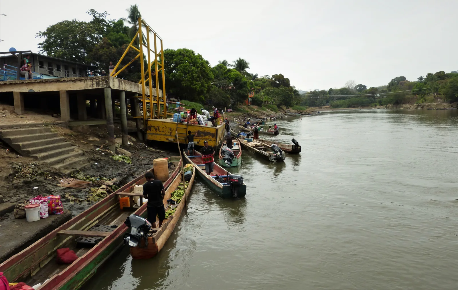
For decades engineers have debated whether this stretch should be completed at all. Nature conservation, Indigenous lands and extraordinary biodiversity keep Darién one of the last great roadless regions on the planet.
Panama City: Where All Roads Meet
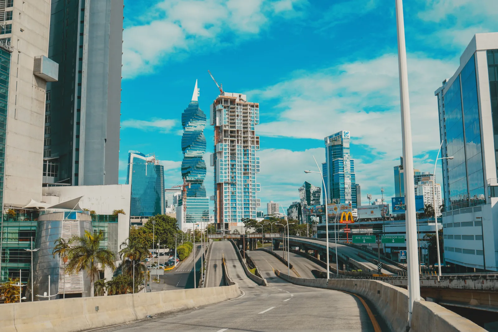
Almost every important road in Panama eventually leads to the capital. That is no accident: Panama City is the country’s financial center, its largest metropolitan area, its main port, its main airport and the home of the Panama Canal. Its network of expressways reflects that importance: highways link residential neighborhoods with business centers, industrial zones, shopping districts and Tocumen International Airport.
For people moving to Panama, daily life often depends not on distance but on which highway you can get onto. Two apartments may stand a couple of kilometers apart, yet one will have a noticeably shorter commute — simply because it is closer to a major road. That is why experienced investors always study transportation before they buy.
The Northern and Southern Corridors
The capital’s transportation system is built around two toll expressways. The Corredor Norte serves the northern part of the city and quickly links residential neighborhoods, business districts and Tocumen Airport. The Corredor Sur runs along the Pacific coast and connects downtown with the airport, bypassing most of the city’s traffic.
These highways cut travel times dramatically. For anyone who works in the financial district, access to a corridor can mean the difference between twenty minutes and more than an hour at rush hour.
In real estate, convenience often translates directly into value.
Bridges Between Two Oceans
One of Panama’s most fascinating engineering stories is not the canal itself but the bridges across it. Every day thousands of cars cross over water that carries some of the largest ships in the world.
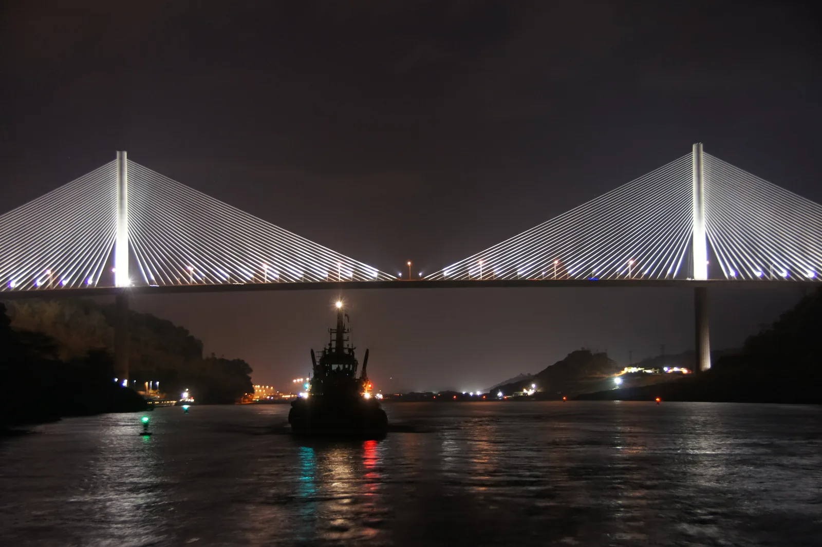
Later came the Centennial Bridge, a modern cable-stayed bridge built to handle growing traffic without interfering with canal operations. It was named for Panama’s centennial, which the country celebrated in 2003. The bridge rises 80 meters above the canal, and the largest ships pass freely beneath it.
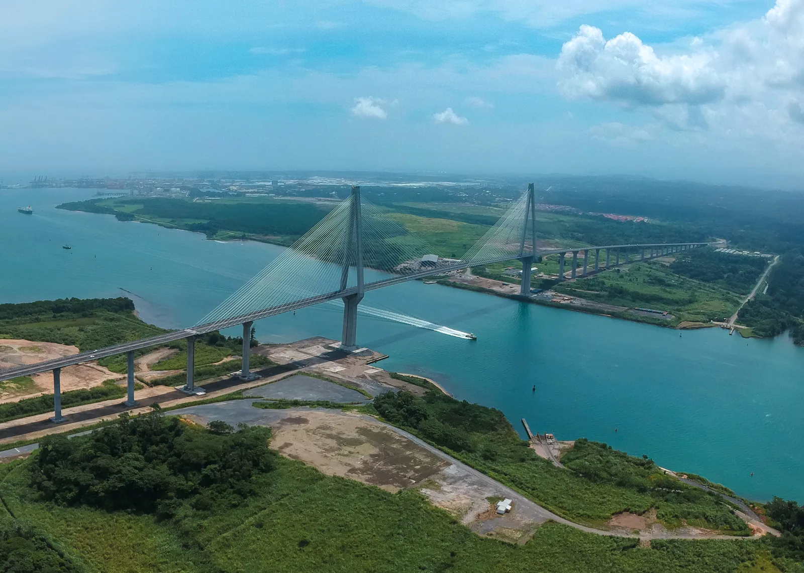
In 2019 the Atlantic Bridge — the third across the canal — opened at the canal’s Caribbean entrance, not far from the locks. Its main span is 530 meters, making it the longest bridge in the country. A fourth is now under construction — about 3.6 kilometers long; it is scheduled for completion at the end of 2028.
World Trade, Seen from a Traffic Jam
There are few places on Earth where the morning commute can slow down while one of the world’s largest container ships glides quietly beneath the bridge. In Panama it happens every day. Drivers on the Bridge of the Americas or the Centennial Bridge look down on ships carrying cars from Japan, coffee from Colombia, electronics from Asia or grain from North America.
Panama’s roads and the canal are not two separate systems but parts of one vast transportation network.
Roads That Build New Districts
Roads do more than connect cities — they create entire new districts. Throughout Panama’s history, new highways have turned farmland into residential neighborhoods, beach villages into resorts and industrial zones into business centers.
Take Panama Pacifico. The area grew up around a former military base, and it was easy access to the highways that helped turn it into one of the fastest-growing mixed-use communities in the country. In the same way, new roads spurred residential construction in Costa Verde, Arraiján, La Chorrera and other western areas.
Access creates demand. Demand creates development. Development raises land values.
For investors, a new road is often a signal of future growth. This pattern has repeated itself in Panama for decades.
Road Trips Across Panama
One of Panama’s great advantages is how quickly the scenery changes. The morning begins among the glass towers of Panama City. By lunchtime you are driving past rolling pastures. An hour later there is rainforest on both sides of the road, and soon the Pacific comes into view. Farther west the air gradually cools, and the road climbs into the mountains — toward Boquete and Volcán.
Few places let you see tropical beaches, cloud forests, coffee plantations and modern cities in a single day’s drive.
Popular Routes
Panama is a wonderful country for driving: distances are reasonable, the roads between major cities are generally in good condition, and the changing scenery makes even a long drive a pleasure.
- Panama City to Coronado along the Pacific coast.
- Panama City to El Valle de Antón, a town inside the crater of an extinct volcano.
- Panama City to Boquete: through a changing climate to mountain landscapes.
- Panama City to Pedasí on the Azuero Peninsula.
- David to Volcán through coffee country and mountain villages.
Each route reveals a different Panama.
Roads and Real Estate
Transportation has always influenced property values, and Panama is no exception. Residential developments with direct access to major highways tend to be in higher demand: they shorten commutes and make life more convenient.
Commercial real estate needs good roads just as much. Shopping centers need visibility, warehouses need truck access, offices need an easy commute for employees, and hotels need a link to the airport. Roads quietly support every segment of the market.
Buyers should weigh accessibility alongside architecture, views and price.
Sometimes the best investment is not the apartment with the best ocean view but the one with the shortest commute.
Safety and Road Conditions
On the main highways, driving in Panama is generally straightforward: the roads between major cities are of good quality, the signage is clear and gas stations are frequent.
- Panama City has traffic jams during the morning and evening rush hours.
- Mountain roads call for attention: curves, changeable weather and sometimes fog.
- In the rainy season a heavy tropical downpour can briefly reduce visibility — but it usually passes quickly.
Most foreigners find driving in Panama easier than in many other Latin American countries.
More Than Asphalt
Infrastructure continues to shape Panama’s future. New highways, interchanges and regional roads are making more and more areas attractive for living and doing business. Every improvement in access opens up opportunities: areas become easier to reach, businesses gain better logistics, tourism grows — and prices often rise in their wake. For the long-term investor, road infrastructure is one of the most reliable indicators of future growth.
Panama’s roads are the invisible links between beaches, ports, mountains, airports, business districts, farms and residential neighborhoods. They connect people with opportunities, businesses with markets, homes with workplaces and investors with new regions.
Just as the canal transformed world shipping, the road network continues to transform Panama itself.
Every new highway shortens distances. Every bridge opens up new opportunities. For anyone discovering Panama — traveler, entrepreneur, retiree or investor — roads are more than a way to get from one place to another. They are one of the foundations on which modern Panama is built.